CA report for renewable energy project released for public exhibition
By Tara Chilcott
August 12, 2024
Cosmos Archaeology has delivered an extensive Underwater Cultural Heritage and Archaeology Impact Assessment for a significant clean energy project earmarked for Bass Strait.
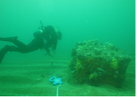
CA was engaged to undertake maritime cultural heritage and archaeology investigations as part of the Commonwealth’s Environmental Impact Assessment process for the proposed Marinus Link project. Marinus Link is a planned undersea and underground electricity and data interconnector between North West Tasmania and the Latrobe Valley in Victoria. From Heybridge, Tasmania, Marinus Link’s cables will cross Bass Strait, buried in the seabed. The cables will then cross the shore at Waratah Bay, about 3 km west of Sandy Point, and run underground north through South Gippsland into the Latrobe Valley.
CA’s Impact Assessment is now available online for public exhibition, alongside several other environmental studies which contributed to the project’s overall EIS/EES requirements. The CA report can be found here.
The project includes the installation of two near parallel sets of high voltage direct current (HVDC) cables on and/or into the seabed. No wrecks were identified along the cable alignments however a number of submerged land features were observed along the route such as beach ridges, paleo water courses and a large lake which once filled the central part of Bass Strait over 20,000 years ago. Marinus Link is currently in planning and development, with Stage 1 construction expected to begin in 2026 and be completed by 2030.